

 The automated system in combination with the first-class service from our local network supports you in every project phase: from planning to execution and evaluation of the collected data.
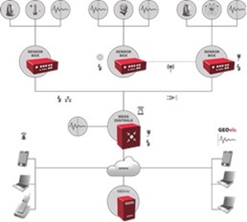
- Thanks to the modular system architecture, the GeoMonitoring network can be easily and quickly adapted to changing project requirements. This saves time and costs and ensures decision-makers have the information they need in every project situation.
- Flexible when connecting a large number of sensors
- Calculation of virtual sensors (e.g. track twisting)
- Combined evaluation of different sensors